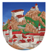
 Dürnstein
Hiking Highlights
")
Hikes Through Dürnstein and Loiben
Experience the outdoors on breathtaking hiking trails through the vineyards of the Wachau. The new hiking and cycling maps through the villages of Dürnstein, Weißenkirchen, Spitz and Rossatz are the best accompaniment for your excursions through the region of Wachau. Just ask in your hotel, your bed & breakfast or our tourist-information for this practical little guide.
Download the hiking map as a PDF
The map will give you a good overview of all the different trails (kindly provided by the company Creative Computer Cartography - Putz & Unger www.landkarten.at).
Vineyard-Hike
Starting in Dürnstein, you can hike towards Oberloiben past the French memorial (Franzosendenkmal). At the Cross of Michael (Michaeler Kreuz), go across the tracks and, shortly afterwards, go upwards to the right, turning onto Loibenberg. You can hike further past Loibenberg until your reach Pfaffenberg and then finish the hike in Förthof at the railway station Stein/Mautern. You can go back by train from April to October (train timetable information at www.noevog.at) or by bus all year round (hourly connections). Hiking time is around 2 to 3 hours.
 Latzer")
Vogelberg-Tour
You can hike downhill on the street past the Schlosshotel (Richard Löwenherz) and keep right (past a villa) towards Talgraben. After crossing the railway tracks via two tunnels, follow the trail until the end of the valley (Talende). From there, the trail goes left (green markings) up to Vogelberg - this is a more challenging trail with course gravel and narrow pathways along the rock face; therefore, it is only recommended for experienced hikers with sturdy footwear. On the crest of the mountain, stay right and hike further to a lodge (Fesslhütte) for traditional snacks and refreshments: Jausenstation Fesslhütte, from there you can continue to the look-out point at Starhemberg, and then back via the ruin to Dürnstein. Hiking time is around 2 to 3 hours.
Look-Out Point: Ferdinandswarte via "Stickelsteig"
Cross the Danube with the ferry and hike from Rossatzbach for about 1km downstream to Windstallgraben. The trail “Stickelsteig” begins in Windstallgraben (a narrow, steeply ascending pathway). The green and white markings are only accurate part of the time, but the almost straight valley floor provides more accurate orientation, and you can hike up through the Bergener highlands. At 400m altitude, there is a traversing path that leads to the Red Cross that you can take in the opposite direction, towards the east. Göttweig is ahead of you and Dürnstein is to the left; follow the idyllic field path to a final sign that points towards the look-out point Ferdinandswarte at 372m. From there you can enjoy the magnificent panorama view of Rossatz > Dürnstein > Loiben > Stein and Krems all the way to Göttweig! An easily visible blue and white marking leads steeply down across the Danube Slope (Donauleiten) to the Danube Street (Donaustraße). From there, you can walk back to Rossatzbach and take the ferry back to Dürnstein. Hiking time around 2 ½ hours..
Across Kuhberg, Kellerberg and Höherreck the French Memorial (Franzosendenkmal)
 Schwarz")
Directly after the city gate, turn left and follow the upward sloping street until you reach the last building (an unplastered stone house) on the right by a rock wall. Hike past this house and walk across the mountain crest of Kuhberg, keep left on a narrow path between a rock wall and a hedge of shrubs until you reach the picture of the Virgin Mary (attached to a tree). From there, turn right (across Talsohle) and, slightly ascending, hike further up Kellerberg. After about 250 meters, leave the wooded area and enjoy the fabulous view at the beginning of the vineyards – Güterweges von Kellerberg. Follow the agricultural road until the next valley trench and turn left at the house by the elevated water tank. From there the path ascends slightly until the end of the valley. Then leave the wide agricultural road at the second curve on the right and follow the path that leads about 200 meters through a wooded area, then back along the mountain crest until you are above the French memorial (Franzosendenkmals) again. Hike around this hill as well until the next valley trench (called Mentalgraben) and return to the street of Mentalgraben, cross the railways tracks at “Michaeler-Kreuz” and walk another kilometer back to Dürnstein. Hiking time around 2 ½ hours.
The "Jankerl-Weg" in Rossatz
Cross the Danube with the ferry and walk until the place name sign of Rossatz. On the left, a road and then a path branches off to the "Jankerl-Weg". Ascending slightly, the path will lead you past a water reservoir up the mountain in serpentines. On the way, there are several breathtaking look-out points towards Dürnstein. Almost at the crest, the trail leads to a forest road that takes you further west (circa 1.5 km). Follow the blue markings and go down the mountain crest. At the western place-name-sign of Rossatz, the trail leads you back to the village. Hiking time around 1.5 hours.
 Donau Niederösterreich/Klaus Engelmayer")
The Orchard Tour
Cross the Danube with the ferry. Right after getting off the ferry, follow the first path to the right. You will hike past the orchards and vineyards along the village of Rossatz to Rührsdorf. In Rührsdorf, we recommend the wine tavern "Winzerstüberl" belonging to the family Eßl, which lies directly on the hiking trail, for a little rest (please note: Monday and Tuesday closed). Once revived, continue walking further to St. Lorenzen. Here you can cross the Danube with the ferry (please note: from 12:00 – 13:30 is lunch break!) to Weißenkirchen. From Weißenkirchen, the best way to return to Dürnstein is by bus - hourly connections. (This is an about 7km flat hiking and cycling trail).
A little cycling excursion through the region of the Wachau
 Donau Niederösterreich/Steve Haider")
In the morning, take the bus to Spitz (travel time around 15 Minuten) – hourly connections. At the railway station Spitz, rent bicycles (from May to October) and cycle to the Museum of Shipping (open from 10-12am and 2-4pm from April to October) in Spitz. After a short ascension (about 15-20 minutes) up to the ruin “Hinterhaus”, you can enjoy a beautiful view of the Danube valley. Later cross the Danube with the ferry to Mitterarnsdorf and cycle on the right bank past villages along the Danube to St. Lorenzen (no restaurant) and cross the Danube by ferry (please note: from 12:00 – 13:30 is lunch break!) to Weißenkirchen; cross the main road and you can choose whether you would like to spend some time in Weißenkirchen. Sights: Wehrkirche (fortress church), Teisenhofer-Hof (farm), Wachau Museum (in Teisenhofer-Hof - open from May to October Tuesday to Sunday from 10am to 5pm).
If not, cycle towards the crossing of the highway heading north, and a bit further on, the road forks; keep left, and then turn left after around 30m before the railway junction towards Joching. The bicycle-path leads through vineyards until St. Michael. There you can take a little cultural stop. St. Michael: visit the Wehrkirche (fortress church), the oldest church in Wachau. When you cycle a little further, you arrive back in Spitz (before the village to the north, you need to cross the railway and head towards Spitz). At the Spitz railway station, return the bicycles to the rental company, and if you like, you can take the next bus to Dürnstein (travel time about 15 minutes) – hourly connections.